
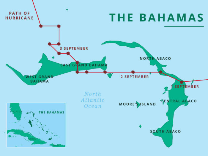
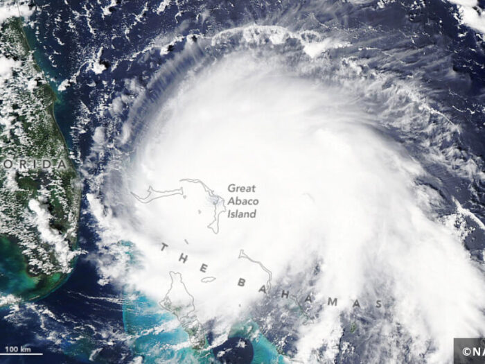
Hurricane Dorian, a Category 5 storm, hit the Bahamas in early September 2019. With winds of up to 220 mph and storm surges of up to 23 feet, it was one of the most powerful Atlantic hurricanes to make landfall.
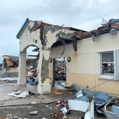
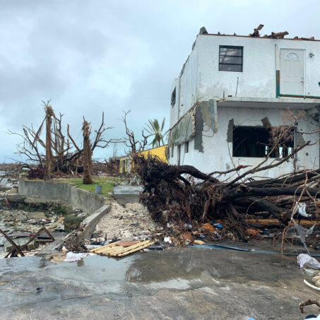
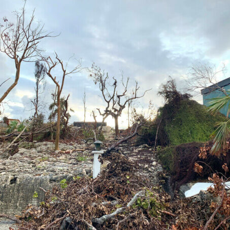
The storm caused widespread flooding and destruction across Grand Bahama Island, killing at least 50 people and leaving over 70,000 people in urgent need of humanitarian assistance. Dorian was the first major hurricane of the 2019 Hurricane Season.
Latest Updates
Soon after Hurricane Dorian made landfall, we sent a ShelterBox assessment team in the Bahamas.
Our teams conducted exhaustive research alongside IOM and the Red Cross, and met with our local Rotary contacts and other humanitarian agencies.
They visited the Abaco islands in order to understand the needs of people who had been affected the most, but didn’t find unmet emergency shelter needs.
Our teams are no longer in the country, but our work in the Bahamas will not stop. We’ll stay in contact with Rotary, the Government and with the other organisations who worked as part of the coordinated response. We will be ready to return if we have a part to play in future plans.
Key Facts About Hurricane Dorian
When did Hurricane Dorian happen?
A low-pressure system formed on August 23, strengthening to a tropical storm on August 24 and becoming a hurricane on August 28. Dorian was the fourth named storm of the 2019 hurricane season, which runs from June 1 to November 30.
How strong was Hurricane Dorian?
At it strongest, Dorian was a category 5 hurricane. This is the strongest recorded hurricane in the Bahamas’ history, with wind speeds of 185 mph and storm surge of up to 23 feet.
What areas were worst affected?
The islands of Abaco and Grand Bahama were the worst affected, with an estimate of 13,000 homes severely damaged or destroyed.
How many people were affected?
At least 65 people were confirmed to have died, with many more missing. Around 76,000 people are thought to have been affected.
2019 Hurricane Season
- In an average season, there are 12 named storms, including six hurricanes, with about half of them being major hurricanes with winds of 111 mph or greater.
- In previous years over 80% of hurricane season activity has occurred during the two-month stretch from 20 August to 20 October.
- Each year, Colorado State University’s (CSU) Tropical Meteorology Project issues an updated outlook in order to account for the various summer changes. In August 2019 they predicted 14 named storms, seven hurricanes and two major hurricanes.
- Near-normal tropical storm activity was predicted for the Atlantic Ocean in 2019, according to NOAA, the National Oceanic and Atmospheric Administration.

Hows does ShelterBox Monitor Hurricanes
When we’re monitoring a tropical storm, we use a variety of sources to give us a detailed overview of the situation.
- Windy – this lets us see current weather updates and weather patterns for the next 7/8 days. We can normally identify ahead of time when it looks like a tropical storm / hurricane will start to form, and we can then monitor the storm accordingly.
- GDACS – The Global Disaster Alert and Coordination System is a resource that provides updates on a range of disaster events which rates the overall humanitarian impact of a disaster, and provides updates on the impact of the disaster, as well as resources such as maps of the affected areas.
- Automated Disaster Analysis and Mapping (ADAM) – an interactive map that tracks active tropical storms and earthquakes
- National Hurricane Centre – a website operated by the National Oceanic and Atmospheric Administration (NOAA) that issues updates and key messaging on tropical storms and hurricanes. They also produce detailed maps and issue advisories for areas where a tropical storm or hurricane is expected to make landfall.
- National Oceanic and Atmospheric Administration (NOAA) – A US government agency, that issues a forecast for the hurricane season.
Depending on where a storm is predicted to make landfall, we will often monitor local news sources and government and disaster management agency websites, to understand how governments and local agencies are preparing for and responding to the storm.
We continue to monitor the situation after the storm has made landfall to understand the impact on affected communities, and to see if there will be an emergency shelter need.
We use our response criteria to make the decision around whether or not we are in a position to respond.
Responding After A Hurricane
Being deployed in the aftermath of either a hurricane or a typhoon presents many unique challenges.
Constant monitoring and communication between teams at HQ and on the ground are essential to making sure the team are all aware of what the risks are, what the situation is and what the weather conditions are like.
Watch this video to find out what our response teams can expect when they arrive in-country.